
临浦镇 topographic map
Interactive map
Click on the map to display elevation.
About this map
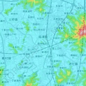
Name: 临浦镇 topographic map, elevation, terrain.
Location: 临浦镇, 萧山区, 杭州市, 浙江省, 中国 (29.98502 120.20908 30.09409 120.27898)
Average elevation: 31 m
Minimum elevation: -3 m
Maximum elevation: 432 m
Other topographic maps
Click on a map to view its topography, its elevation and its terrain.