
下村 topographic map
Interactive map
Click on the map to display elevation.
About this map
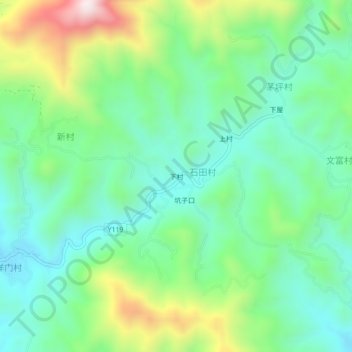
Name: 下村 topographic map, elevation, terrain.
Location: 下村, 大埔县, 梅州市, 广东省, 中国 (24.60474 116.67644 24.64474 116.71644)
Average elevation: 384 m
Minimum elevation: 194 m
Maximum elevation: 824 m
Other topographic maps
Click on a map to view its topography, its elevation and its terrain.