
郧西县 topographic map
Interactive map
Click on the map to display elevation.
About this map
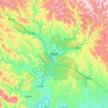
Name: 郧西县 topographic map, elevation, terrain.
Location: 郧西县, 十堰市, 湖北省, 中国 (32.83478 110.26059 33.15478 110.58059)
Average elevation: 524 m
Minimum elevation: 149 m
Maximum elevation: 1,198 m
Other topographic maps
Click on a map to view its topography, its elevation and its terrain.