
马安镇 topographic map
Interactive map
Click on the map to display elevation.
About this map
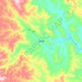
Name: 马安镇 topographic map, elevation, terrain.
Location: 马安镇, 郧西县, 十堰市, 湖北省, 中国 (32.93680 110.16743 33.01680 110.24743)
Average elevation: 636 m
Minimum elevation: 299 m
Maximum elevation: 1,111 m
Other topographic maps
Click on a map to view its topography, its elevation and its terrain.