
上津镇 topographic map
Interactive map
Click on the map to display elevation.
About this map
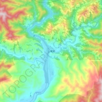
Name: 上津镇 topographic map, elevation, terrain.
Location: 上津镇, 郧西县, 十堰市, 湖北省, 中国 (33.11517 109.99872 33.19517 110.07872)
Average elevation: 521 m
Minimum elevation: 257 m
Maximum elevation: 1,045 m
Other topographic maps
Click on a map to view its topography, its elevation and its terrain.