
昌江县 topographic map
Interactive map
Click on the map to display elevation.
About this map
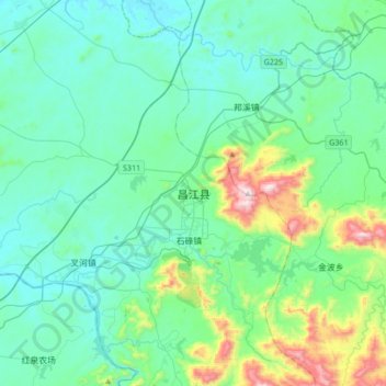
Name: 昌江县 topographic map, elevation, terrain.
Location: 昌江县, 昌江黎族自治县, 海南省, 中国 (19.13837 108.89149 19.45837 109.21149)
Average elevation: 151 m
Minimum elevation: 3 m
Maximum elevation: 840 m
Other topographic maps
Click on a map to view its topography, its elevation and its terrain.