
Thank you for supporting this site ❤️
Make a donation
Make a donation
Hoyes Run topographic map
Click on the map to display elevation.
Thank you for supporting this site ❤️
Make a donation
Make a donation
About this map
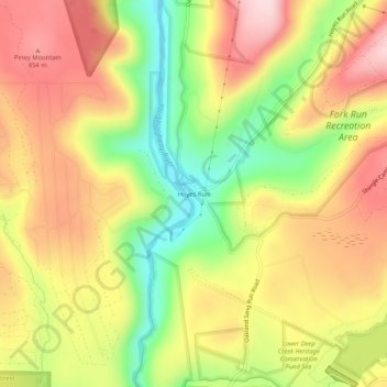
Name: Hoyes Run topographic map, elevation, terrain.
Location: Hoyes Run, Garrett County, Maryland, United States (39.50815 -79.43060 39.54815 -79.39060)
Average elevation: 756 m
Minimum elevation: 609 m
Maximum elevation: 883 m
Thank you for supporting this site ❤️
Make a donation
Make a donation
Other topographic maps
Click on a map to view its topography, its elevation and its terrain.
Deep Creek Lake Natural Resource Management Area
United States > Maryland > Garrett County > McHenry
Average elevation: 793 m
Thank you for supporting this site ❤️
Make a donation
Make a donation
Thank you for supporting this site ❤️
Make a donation
Make a donation