
Thank you for supporting this site ❤️
Make a donation
Make a donation
Kitzmiller topographic map
Click on the map to display elevation.
Thank you for supporting this site ❤️
Make a donation
Make a donation
About this map
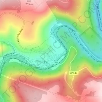
Name: Kitzmiller topographic map, elevation, terrain.
Location: Kitzmiller, Garrett County, Maryland, United States (39.38513 -79.19033 39.39451 -79.17690)
Average elevation: 604 m
Minimum elevation: 449 m
Maximum elevation: 756 m
Thank you for supporting this site ❤️
Make a donation
Make a donation
Other topographic maps
Click on a map to view its topography, its elevation and its terrain.