
虹桥 topographic map
Interactive map
Click on the map to display elevation.
About this map
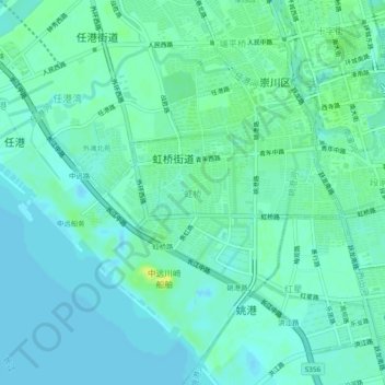
Name: 虹桥 topographic map, elevation, terrain.
Location: 虹桥, 南通市, 江苏省, 226000, 中国 (31.98230 120.82362 32.02230 120.86362)
Average elevation: 5 m
Minimum elevation: -5 m
Maximum elevation: 17 m
Other topographic maps
Click on a map to view its topography, its elevation and its terrain.