
怀洪新河 topographic map
Interactive map
Click on the map to display elevation.
About this map
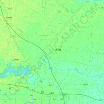
Name: 怀洪新河 topographic map, elevation, terrain.
Location: 怀洪新河, 怀远县, 蚌埠市, 安徽省, 中国 (32.99558 117.17220 33.19784 117.30568)
Average elevation: 21 m
Minimum elevation: 14 m
Maximum elevation: 29 m
Other topographic maps
Click on a map to view its topography, its elevation and its terrain.