
熊岳镇 topographic map
Interactive map
Click on the map to display elevation.
About this map
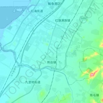
Name: 熊岳镇 topographic map, elevation, terrain.
Location: 熊岳镇, 鲅鱼圈区, 营口市, 辽宁省, 115000, 中国 (40.14892 122.04129 40.22306 122.19242)
Average elevation: 24 m
Minimum elevation: -2 m
Maximum elevation: 250 m
Other topographic maps
Click on a map to view its topography, its elevation and its terrain.