
塔寺村 topographic map
Interactive map
Click on the map to display elevation.
About this map
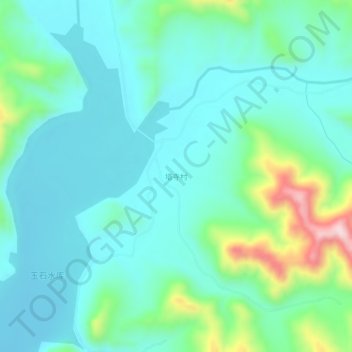
Name: 塔寺村 topographic map, elevation, terrain.
Location: 塔寺村, 营口市, 辽宁省, 中国 (40.11427 122.70047 40.15427 122.74047)
Average elevation: 263 m
Minimum elevation: 184 m
Maximum elevation: 564 m
Other topographic maps
Click on a map to view its topography, its elevation and its terrain.