
老边区 topographic map
Interactive map
Click on the map to display elevation.
About this map
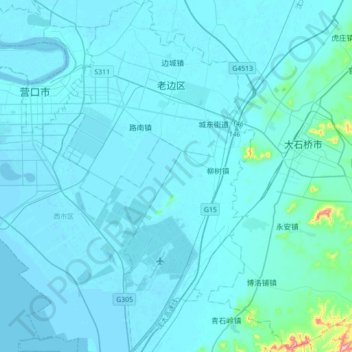
Name: 老边区 topographic map, elevation, terrain.
Location: 老边区, 营口市, 辽宁省, 115000, 中国 (40.47633 122.24350 40.74325 122.45587)
Average elevation: 12 m
Minimum elevation: -3 m
Maximum elevation: 270 m
Other topographic maps
Click on a map to view its topography, its elevation and its terrain.