
Thank you for supporting this site ❤️
Make a donation
Make a donation
Chester topographic map
Click on the map to display elevation.
Thank you for supporting this site ❤️
Make a donation
Make a donation
About this map
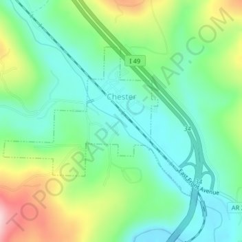
Name: Chester topographic map, elevation, terrain.
Location: Chester, Crawford County, Arkansas, 72934, United States (35.66987 -94.19147 35.68644 -94.16556)
Average elevation: 313 m
Minimum elevation: 238 m
Maximum elevation: 475 m
Thank you for supporting this site ❤️
Make a donation
Make a donation
Other topographic maps
Click on a map to view its topography, its elevation and its terrain.
Thank you for supporting this site ❤️
Make a donation
Make a donation
Thank you for supporting this site ❤️
Make a donation
Make a donation