
Thank you for supporting this site ❤️
Make a donation
Make a donation
Uniontown topographic map
Click on the map to display elevation.
Thank you for supporting this site ❤️
Make a donation
Make a donation
About this map
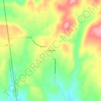
Name: Uniontown topographic map, elevation, terrain.
Location: Uniontown, Crawford County, Arkansas, 72955, United States (35.56453 -94.46410 35.60453 -94.42410)
Average elevation: 259 m
Minimum elevation: 192 m
Maximum elevation: 334 m
Thank you for supporting this site ❤️
Make a donation
Make a donation
Other topographic maps
Click on a map to view its topography, its elevation and its terrain.
Thank you for supporting this site ❤️
Make a donation
Make a donation
Thank you for supporting this site ❤️
Make a donation
Make a donation