
Thank you for supporting this site ❤️
Make a donation
Make a donation
Grote-Brogel topographic map
Click on the map to display elevation.
Thank you for supporting this site ❤️
Make a donation
Make a donation
About this map
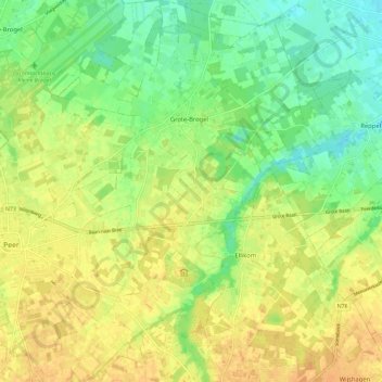
Name: Grote-Brogel topographic map, elevation, terrain.
Location: Grote-Brogel, Peer, Maaseik, Limburg, België (51.10591 5.47030 51.17797 5.54762)
Average elevation: 59 m
Minimum elevation: 42 m
Maximum elevation: 72 m
Thank you for supporting this site ❤️
Make a donation
Make a donation
Other topographic maps
Click on a map to view its topography, its elevation and its terrain.