
Greenland ice sheet topographic map
Interactive map
Click on the map to display elevation.
About this map
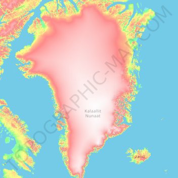
Name: Greenland ice sheet topographic map, elevation, terrain.
Location: Greenland ice sheet, Sermersooq, Greenland (60.58450 -72.81262 82.18280 -19.30332)
Average elevation: 796 m
Minimum elevation: -2 m
Maximum elevation: 3,522 m
Other topographic maps
Click on a map to view its topography, its elevation and its terrain.
Traill-iup Immikkeertivi
Traill-iup Immikkeertivi, Sermersooq, Greenland
Average elevation: 0 m
Geographical Society Island
Geographical Society Island, Sermersooq, Greenland
Average elevation: 178 m