
Thank you for supporting this site ❤️
Make a donation
Make a donation
Evans Falls topographic map
Click on the map to display elevation.
Thank you for supporting this site ❤️
Make a donation
Make a donation
About this map
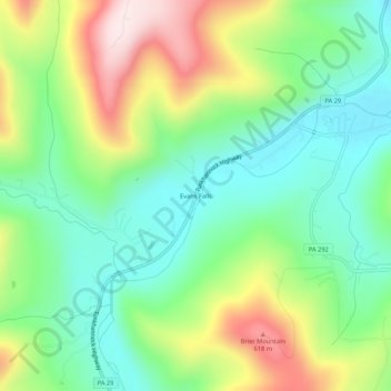
Name: Evans Falls topographic map, elevation, terrain.
Location: Evans Falls, Wyoming County, Pennsylvania, United States (41.44591 -76.03798 41.48591 -75.99798)
Average elevation: 378 m
Minimum elevation: 208 m
Maximum elevation: 683 m
Thank you for supporting this site ❤️
Make a donation
Make a donation
Other topographic maps
Click on a map to view its topography, its elevation and its terrain.