
Thank you for supporting this site ❤️
Make a donation
Make a donation
Laceyville topographic map
Click on the map to display elevation.
Thank you for supporting this site ❤️
Make a donation
Make a donation
About this map
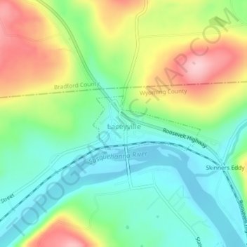
Name: Laceyville topographic map, elevation, terrain.
Location: Laceyville, Wyoming County, Pennsylvania, United States (41.64320 -76.16585 41.64921 -76.15015)
Average elevation: 254 m
Minimum elevation: 187 m
Maximum elevation: 370 m
Thank you for supporting this site ❤️
Make a donation
Make a donation
Other topographic maps
Click on a map to view its topography, its elevation and its terrain.