
Thank you for supporting this site ❤️
Make a donation
Make a donation
Meshoppen topographic map
Click on the map to display elevation.
Thank you for supporting this site ❤️
Make a donation
Make a donation
About this map
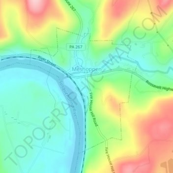
Name: Meshoppen topographic map, elevation, terrain.
Location: Meshoppen, Wyoming County, Pennsylvania, United States (41.60222 -76.05822 41.62068 -76.03574)
Average elevation: 249 m
Minimum elevation: 182 m
Maximum elevation: 368 m
Thank you for supporting this site ❤️
Make a donation
Make a donation
Other topographic maps
Click on a map to view its topography, its elevation and its terrain.