
Thank you for supporting this site ❤️
Make a donation
Make a donation
Folgosa topographic map
Click on the map to display elevation.
Thank you for supporting this site ❤️
Make a donation
Make a donation
About this map
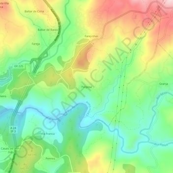
Name: Folgosa topographic map, elevation, terrain.
Location: Folgosa, Castro Daire, Viseu, 3600-143, Portugal (40.87488 -7.91808 40.91488 -7.87808)
Average elevation: 596 m
Minimum elevation: 461 m
Maximum elevation: 806 m
Thank you for supporting this site ❤️
Make a donation
Make a donation
Other topographic maps
Click on a map to view its topography, its elevation and its terrain.