
周家镇 topographic map
Interactive map
Click on the map to display elevation.
About this map
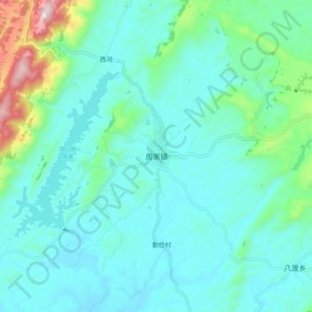
Name: 周家镇 topographic map, elevation, terrain.
Location: 周家镇, 大竹县, 达州市, 四川省, 中国 (30.57075 107.31801 30.65075 107.39801)
Average elevation: 443 m
Minimum elevation: 353 m
Maximum elevation: 874 m
Other topographic maps
Click on a map to view its topography, its elevation and its terrain.