
瓦屋山 topographic map
Interactive map
Click on the map to display elevation.
About this map
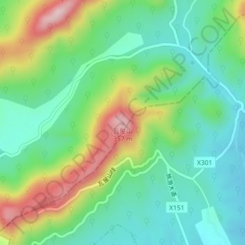
Name: 瓦屋山 topographic map, elevation, terrain.
Location: 瓦屋山, 镇江市, 江苏省, 中国 (31.65294 119.28412 31.65304 119.28422)
Average elevation: 157 m
Minimum elevation: 62 m
Maximum elevation: 348 m
Other topographic maps
Click on a map to view its topography, its elevation and its terrain.