Geolocate

延陵镇 topographic map

Interactive map

Click on the map to display elevation.

About this map

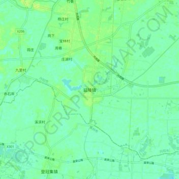
Name: 延陵镇 topographic map, elevation, terrain.

Location: 延陵镇, 镇江市, 江苏省, 中国 (31.84470 119.43562 31.92470 119.51562)

Average elevation: 7 m

Minimum elevation: 1 m

Maximum elevation: 13 m

Other topographic maps

Click on a map to view its topography, its elevation and its terrain.

上党镇

中国 > 江苏省 > 镇江市

上党镇, 镇江市, 江苏省, 212100, 中国

Average elevation: 29 m

焦山

中国 > 江苏省 > 镇江市

焦山, 镇江市, 江苏省, 212001, 中国

Average elevation: 5 m

洪山

中国 > 江苏省 > 镇江市

洪山, 镇江市, 江苏省, 中国

Average elevation: 52 m

瓦屋山

中国 > 江苏省 > 镇江市

瓦屋山, 镇江市, 江苏省, 中国

Average elevation: 157 m

茅山镇

中国 > 江苏省 > 镇江市 > 茅山镇

茅山镇, 镇江市, 句容市, 江苏省, 212400, 中国

Average elevation: 31 m