
潜山市 topographic map
Interactive map
Click on the map to display elevation.
About this map
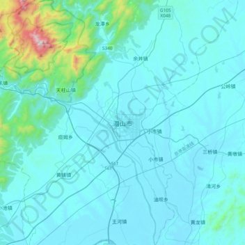
Name: 潜山市 topographic map, elevation, terrain.
Location: 潜山市, 安庆市, 安徽省, 246300, 中国 (30.47973 116.41672 30.79973 116.73672)
Average elevation: 120 m
Minimum elevation: 12 m
Maximum elevation: 1,402 m
Other topographic maps
Click on a map to view its topography, its elevation and its terrain.