
天柱山镇 topographic map
Interactive map
Click on the map to display elevation.
About this map
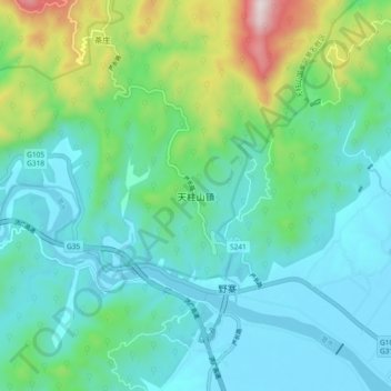
Name: 天柱山镇 topographic map, elevation, terrain.
Location: 天柱山镇, 潜山市, 安庆市, 安徽省, 中国 (30.64330 116.45051 30.72330 116.53051)
Average elevation: 212 m
Minimum elevation: 26 m
Maximum elevation: 895 m
Other topographic maps
Click on a map to view its topography, its elevation and its terrain.