
故陵镇 topographic map
Interactive map
Click on the map to display elevation.
About this map
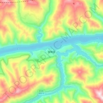
Name: 故陵镇 topographic map, elevation, terrain.
Location: 故陵镇, 云阳县, 渝东北三峡库区城镇群区位, 重庆市, 中国 (30.90160 109.03790 30.98160 109.11790)
Average elevation: 425 m
Minimum elevation: 78 m
Maximum elevation: 953 m
Other topographic maps
Click on a map to view its topography, its elevation and its terrain.