
草地梁村 topographic map
Interactive map
Click on the map to display elevation.
About this map
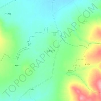
Name: 草地梁村 topographic map, elevation, terrain.
Location: 草地梁村, 喀喇沁旗, 赤峰市, 内蒙古自治区, 中国 (41.91064 119.14547 41.95064 119.18547)
Average elevation: 619 m
Minimum elevation: 574 m
Maximum elevation: 714 m
Other topographic maps
Click on a map to view its topography, its elevation and its terrain.