
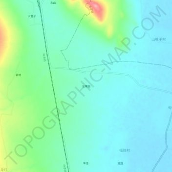
北果园 topographic map
Interactive map
Click on the map to display elevation.
About this map
Name: 北果园 topographic map, elevation, terrain.
Location: 北果园, 乃林镇, 喀喇沁旗, 赤峰市, 内蒙古自治区, 中国 (41.93556 119.24612 41.97556 119.28612)
Average elevation: 528 m
Minimum elevation: 503 m
Maximum elevation: 618 m
Other topographic maps
Click on a map to view its topography, its elevation and its terrain.