
扁担沟 topographic map
Interactive map
Click on the map to display elevation.
About this map
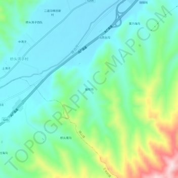
Name: 扁担沟 topographic map, elevation, terrain.
Location: 扁担沟, 锦山镇, 喀喇沁旗, 赤峰市, 内蒙古自治区, 中国 (41.86138 118.65728 41.90138 118.69728)
Average elevation: 841 m
Minimum elevation: 741 m
Maximum elevation: 1,141 m