
青莲山 topographic map
Interactive map
Click on the map to display elevation.
About this map
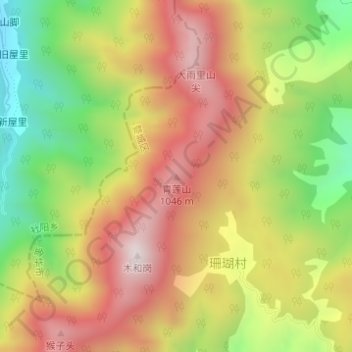
Name: 青莲山 topographic map, elevation, terrain.
Location: 青莲山, 金华市, 浙江省, 中国 (28.82040 119.33836 28.82050 119.33846)
Average elevation: 754 m
Minimum elevation: 361 m
Maximum elevation: 1,112 m
Other topographic maps
Click on a map to view its topography, its elevation and its terrain.