
玉山镇 topographic map
Interactive map
Click on the map to display elevation.
About this map
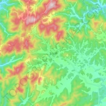
Name: 玉山镇 topographic map, elevation, terrain.
Location: 玉山镇, 金华市, 浙江省, 中国 (29.19653 120.61091 29.27653 120.69091)
Average elevation: 595 m
Minimum elevation: 419 m
Maximum elevation: 877 m
Other topographic maps
Click on a map to view its topography, its elevation and its terrain.