
Thank you for supporting this site ❤️
Make a donation
Make a donation
Swanton topographic map
Click on the map to display elevation.
Thank you for supporting this site ❤️
Make a donation
Make a donation
About this map
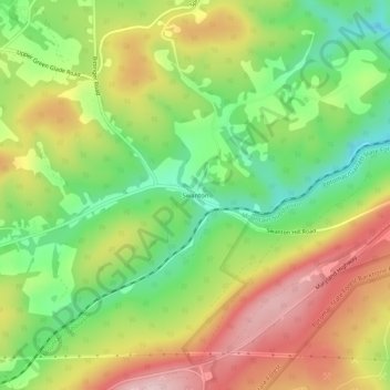
Name: Swanton topographic map, elevation, terrain.
Location: Swanton, Garrett County, Maryland, 21561, United States (39.43898 -79.25087 39.47898 -79.21087)
Average elevation: 789 m
Minimum elevation: 657 m
Maximum elevation: 942 m
Thank you for supporting this site ❤️
Make a donation
Make a donation
Other topographic maps
Click on a map to view its topography, its elevation and its terrain.
Deep Creek Lake Natural Resource Management Area
United States > Maryland > Garrett County > McHenry
Average elevation: 793 m
Thank you for supporting this site ❤️
Make a donation
Make a donation
Thank you for supporting this site ❤️
Make a donation
Make a donation