
得荣县 topographic map
Interactive map
Click on the map to display elevation.
About this map
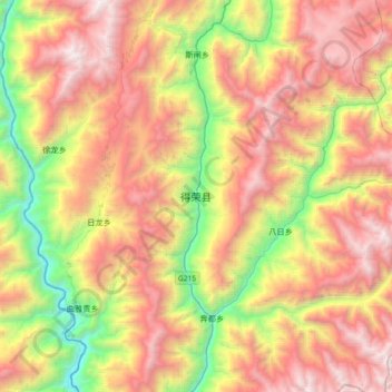
Name: 得荣县 topographic map, elevation, terrain.
Location: 得荣县, 甘孜藏族自治州, 四川省, 627900, 中国 (28.55589 99.12537 28.87589 99.44537)
Average elevation: 3,530 m
Minimum elevation: 2,075 m
Maximum elevation: 5,038 m
Other topographic maps
Click on a map to view its topography, its elevation and its terrain.