
古学乡 topographic map
Interactive map
Click on the map to display elevation.
About this map
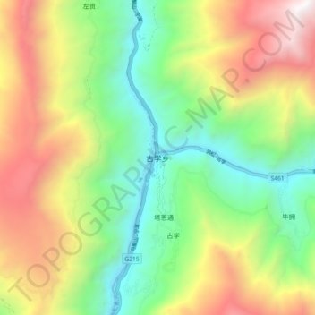
Name: 古学乡 topographic map, elevation, terrain.
Location: 古学乡, 得荣县, 甘孜藏族自治州, 四川省, 627900, 中国 (28.38684 99.21805 28.46684 99.29805)
Average elevation: 3,010 m
Minimum elevation: 2,058 m
Maximum elevation: 4,420 m
Other topographic maps
Click on a map to view its topography, its elevation and its terrain.