
萝岗街道 topographic map
Interactive map
Click on the map to display elevation.
About this map
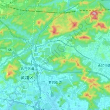
Name: 萝岗街道 topographic map, elevation, terrain.
Location: 萝岗街道, 黄埔区, 广州市, 广东省, 510530, 中国 (23.15466 113.42732 23.25607 113.54895)
Average elevation: 83 m
Minimum elevation: 9 m
Maximum elevation: 406 m
Other topographic maps
Click on a map to view its topography, its elevation and its terrain.