
凤凰湖公园 topographic map
Interactive map
Click on the map to display elevation.
About this map
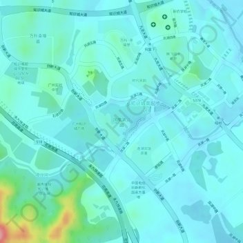
Name: 凤凰湖公园 topographic map, elevation, terrain.
Location: 凤凰湖公园, 龙湖街道, 黄埔区, 广州市, 广东省, 中国 (23.32232 113.53156 23.32849 113.54116)
Average elevation: 49 m
Minimum elevation: 26 m
Maximum elevation: 168 m
Other topographic maps
Click on a map to view its topography, its elevation and its terrain.