
檀峪村 topographic map
Interactive map
Click on the map to display elevation.
About this map
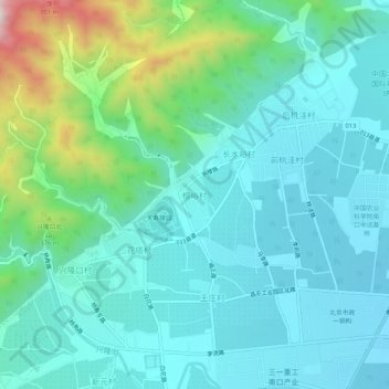
Name: 檀峪村 topographic map, elevation, terrain.
Location: 檀峪村, 昌平区, 北京市, 中国 (40.20629 116.04965 40.24629 116.08965)
Average elevation: 203 m
Minimum elevation: 78 m
Maximum elevation: 701 m
Other topographic maps
Click on a map to view its topography, its elevation and its terrain.