
蒲崗村 topographic map
Interactive map
Click on the map to display elevation.
About this map
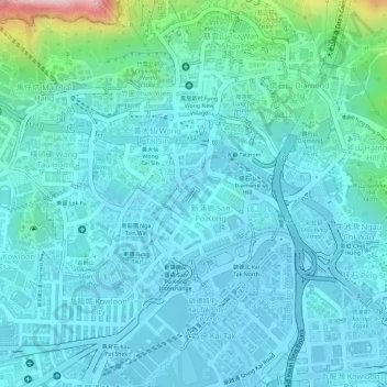
Name: 蒲崗村 topographic map, elevation, terrain.
Location: 蒲崗村, 大磡, 新蒲崗, 黃大仙區, 九龍, 香港, 000000, 中国 (22.32794 114.18715 22.34794 114.20715)
Average elevation: 54 m
Minimum elevation: -3 m
Maximum elevation: 343 m
Other topographic maps
Click on a map to view its topography, its elevation and its terrain.