
台阁牧镇 topographic map
Interactive map
Click on the map to display elevation.
About this map
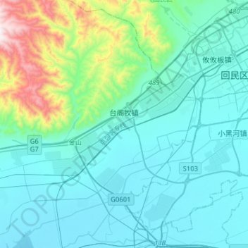
Name: 台阁牧镇 topographic map, elevation, terrain.
Location: 台阁牧镇, 土默特左旗, 呼和浩特市, 内蒙古自治区, 中国 (40.67224 111.41260 40.86577 111.58150)
Average elevation: 1,183 m
Minimum elevation: 1,009 m
Maximum elevation: 2,160 m
Other topographic maps
Click on a map to view its topography, its elevation and its terrain.