
川主寺镇 topographic map
Interactive map
Click on the map to display elevation.
About this map
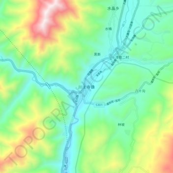
Name: 川主寺镇 topographic map, elevation, terrain.
Location: 川主寺镇, 松潘县, 阿坝藏族羌族自治州, 四川省, 中国 (32.74441 103.58516 32.82441 103.66516)
Average elevation: 3,309 m
Minimum elevation: 2,948 m
Maximum elevation: 4,147 m
Other topographic maps
Click on a map to view its topography, its elevation and its terrain.