
毛儿盖镇 topographic map
Interactive map
Click on the map to display elevation.
About this map
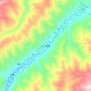
Name: 毛儿盖镇 topographic map, elevation, terrain.
Location: 毛儿盖镇, 松潘县, 阿坝藏族羌族自治州, 四川省, 中国 (32.56097 103.02266 32.64097 103.10266)
Average elevation: 3,591 m
Minimum elevation: 3,143 m
Maximum elevation: 4,295 m
Other topographic maps
Click on a map to view its topography, its elevation and its terrain.