
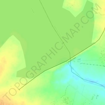
Shashe Dam topographic map
Interactive map
Click on the map to display elevation.
About this map
Name: Shashe Dam topographic map, elevation, terrain.
Location: Shashe Dam, Central District, Botswana (-21.37438 27.41483 -21.35527 27.43940)
Average elevation: 969 m
Minimum elevation: 949 m
Maximum elevation: 982 m
Other topographic maps
Click on a map to view its topography, its elevation and its terrain.
Letsibogo Dam
Letsibogo Dam, Central District, Botswana
Average elevation: 847 m
Motloutse River
Motloutse River, Central District, Botswana
Average elevation: 764 m
Serule
Botswana > Central District > Serule
Serule, Central District, Botswana
Average elevation: 935 m
Bobonong
Botswana > Central District > Bobonong
Bobonong, Central District, Botswana
Average elevation: 691 m
Tutume
Botswana > Central District > Tutume
Tutume, Central District, Botswana
Average elevation: 1,102 m
Selebi Phikwe
Botswana > Central District > Selebi Phikwe
Selebi Phikwe, Central District, Botswana
Average elevation: 863 m
Rakops
Botswana > Central District > Rakops
Rakops, Central District, Botswana
Average elevation: 914 m
Ntwetwe Pan
Ntwetwe Pan, Central District, Botswana
Average elevation: 912 m
Makgadikgadi Pans Game Reserve
Makgadikgadi Pans Game Reserve, Central District, Botswana
Average elevation: 917 m
Boteti River
Boteti River, Central District, Botswana
Average elevation: 908 m
Lotsane Dam
Lotsane Dam, Central District, Botswana
Average elevation: 874 m