
星光村 topographic map
Interactive map
Click on the map to display elevation.
About this map
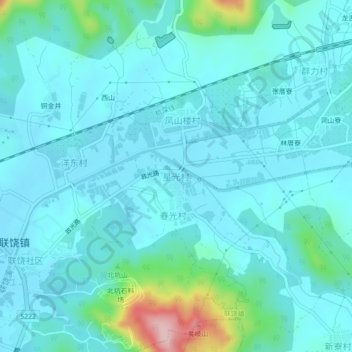
Name: 星光村 topographic map, elevation, terrain.
Location: 星光村, 潮州市, 广东省, 中国 (23.71769 116.98087 23.75769 117.02087)
Average elevation: 37 m
Minimum elevation: 5 m
Maximum elevation: 225 m
Other topographic maps
Click on a map to view its topography, its elevation and its terrain.