
铁涌镇 topographic map
Interactive map
Click on the map to display elevation.
About this map
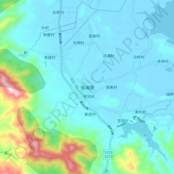
Name: 铁涌镇 topographic map, elevation, terrain.
Location: 铁涌镇, 惠州市, 广东省, 中国 (22.68580 114.79811 22.76580 114.87811)
Average elevation: 91 m
Minimum elevation: -2 m
Maximum elevation: 562 m
Other topographic maps
Click on a map to view its topography, its elevation and its terrain.