
内乡县 topographic map
Interactive map
Click on the map to display elevation.
About this map
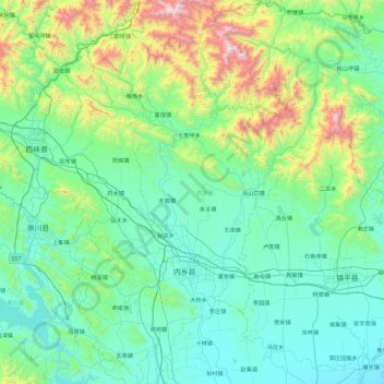
Name: 内乡县 topographic map, elevation, terrain.
Location: 内乡县, 南阳市, 河南省, 中国 (32.81915 111.56372 33.59532 112.15280)
Average elevation: 405 m
Minimum elevation: 113 m
Maximum elevation: 1,815 m
Other topographic maps
Click on a map to view its topography, its elevation and its terrain.