
煤炭坝镇 topographic map
Interactive map
Click on the map to display elevation.
About this map
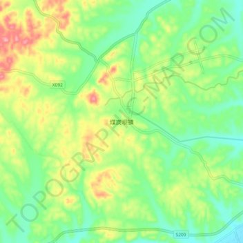
Name: 煤炭坝镇 topographic map, elevation, terrain.
Location: 煤炭坝镇, 宁乡市, 湖南省, 中国 (28.19430 112.34600 28.27430 112.42600)
Average elevation: 109 m
Minimum elevation: 63 m
Maximum elevation: 183 m
Other topographic maps
Click on a map to view its topography, its elevation and its terrain.