
Thank you for supporting this site ❤️
Make a donation
Make a donation
Mezio topographic map
Click on the map to display elevation.
Thank you for supporting this site ❤️
Make a donation
Make a donation
About this map
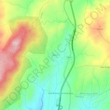
Name: Mezio topographic map, elevation, terrain.
Location: Mezio, Castro Daire, Viseu, Portugal (40.96416 -7.91164 41.00416 -7.87164)
Average elevation: 969 m
Minimum elevation: 833 m
Maximum elevation: 1,155 m
Thank you for supporting this site ❤️
Make a donation
Make a donation
Other topographic maps
Click on a map to view its topography, its elevation and its terrain.