
卢沟桥村 topographic map
Interactive map
Click on the map to display elevation.
About this map
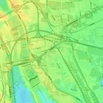
Name: 卢沟桥村 topographic map, elevation, terrain.
Location: 卢沟桥村, 丰台区, 北京市, 中国 (39.82743 116.20693 39.86743 116.24693)
Average elevation: 58 m
Minimum elevation: 42 m
Maximum elevation: 70 m
Other topographic maps
Click on a map to view its topography, its elevation and its terrain.