Geolocate

马屯镇 topographic map

Interactive map

Click on the map to display elevation.

About this map

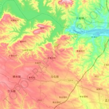
Name: 马屯镇 topographic map, elevation, terrain.

Location: 马屯镇, 孟津区, 洛阳市, 河南省, 中国 (34.81483 112.23744 34.96252 112.40885)

Average elevation: 319 m

Minimum elevation: 123 m

Maximum elevation: 509 m

Other topographic maps

Click on a map to view its topography, its elevation and its terrain.

河图公园

中国 > 河南省 > 孟津区 > 城关镇

河图公园, 城关镇, 孟津区, 洛阳市, 孟津区, 河南省, 中国

Average elevation: 315 m

下院沟

中国 > 河南省 > 孟津区 > 城关镇

下院沟, 城关镇, 孟津区, 洛阳市, 孟津区, 河南省, 471100, 中国

Average elevation: 313 m

城关镇

中国 > 河南省 > 孟津区

城关镇, 孟津区, 洛阳市, 河南省, 471100, 中国

Average elevation: 301 m

吉利街道

中国 > 河南省 > 孟津区

吉利街道, 孟津区, 洛阳市, 河南省, 471012, 中国

Average elevation: 136 m

金村

中国 > 河南省 > 孟津区 > 平乐镇

金村, 平乐镇, 孟津区, 洛阳市, 河南省, 中国

Average elevation: 138 m